Last updated on November 14th, 2023
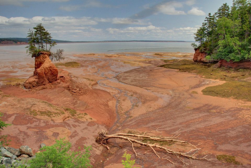
Featured image: Soley Cove’s famous Flower Pot | Photo by Sandra Phinney
Journeys are about letting things unfold
By Sandra Phinney, Contributor, Tales from Atlantic Canada
It’s a blistering summer day and I’ve been hiking for three hours on a forest trail close to Debert, Nova Scotia. Not only am I drenched with sweat—I’m lost. I started this hike on the Mi’kmawey Debert “Paleo-Indian” site, one of the most significant indigenous archeological regions in North America, but I didn’t anticipate that a little trek of 4.4 km would turn into a 10 km exhausting trudge.
Cresting the top of a hill I see a chain link fence surrounding several large transport trucks. The transition from old growth forest to civilization is jarring—yet welcomed. Eventually, I spy a building and enter the front door of Kohltech, a company that makes windows and doors. The receptionist takes one look at me and rushes over with a big mug of icy water. Could she tell me how to get back to the parking lot at the Mi’kmawey Debert trail? “I’ll drive you!”
After a short, grateful, nap in my car, I head for my next destination. Within an hour I’m driving by a tired-looking sign: Welcome to Historic Londonderry. Below, a second sign: City Limits. The latter makes me smile as I know this is now a community of around 100 people, but between 1849 and 1909, Londonderry had been a thriving metropolis. Two million tons of iron ore were mined here.
Checking my guidebook, I read: Londonderry Provincial Park has mining artifacts, while historic slag heaps and ‘beehive’ coke ovens occur just north of the park.
I drive … and drive … and run out of pavement. Backtracking, I stop at the first house and ask directions. “No provincial parks around here.” Repeating this line of inquiry five more times, finally, a white-haired woman in a tiny Hansel and Gretel house says, “Come in!” Setting glasses and cold apple juice on the table, she adds, “Yes. Just keep going and turn right where the Catholic Church is.” My hostess is 86, spry as a squirrel, and her blue eyes dance as if she’s in a state of perpetual glee. She tells me the story of meeting her husband “out west,” how they created a family of nine in this part of the world and … would I like to see her collection of salt and pepper shakers?
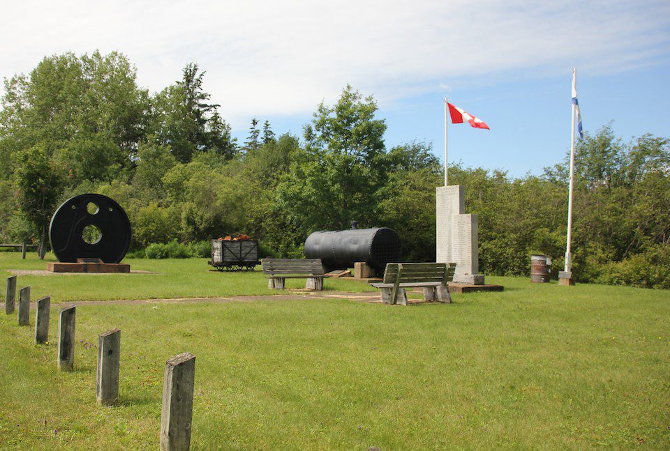
Items from the iron mines in Londonderry village square / Photo by Sandra Phinney
Am I lost?
An hour later, I still can’t find the provincial park. Composing a letter in my head to the folks who published the guidebook, I rant about poor directions, wasting my time, and how not to impress travellers. More knocking on doors; more blank faces. Then, BINGO! A woman says, “Hold on! I’m Sally. I’ll take you there.”
We walk through what looks like a hay field littered with brambles and errant alder bushes. As the community couldn’t afford the upkeep, the park went to seed—literally and figuratively. Out of the blue, she asks, “Would you like to see the coke ovens?”
We drive a short distance, park the car, cross the ditch and veer into the woods. And there they are—fifty semi-circular brick coke ovens side by side, about four feet high and twelve feet wide—like camouflaged caves. “Sometimes we brought our children for picnics in the ovens. They loved that.”
So much invisible history, I think to myself. Wondering out loud why there was no signage or easy access to this site, Sally explains that the coke ovens are on private property. The owner lives in the US and is not interested in selling or partnering with the community.
Sally is 78 and doesn’t have a computer so we exchange addresses and promise to keep in touch. By now the hands on my watch tell me it’s 5:57 p.m. I still have a long drive to reach Spencer’s Island, where I’ve booked a cottage for three nights. Surely, I’ll be able to see more than two Geoparks tomorrow.
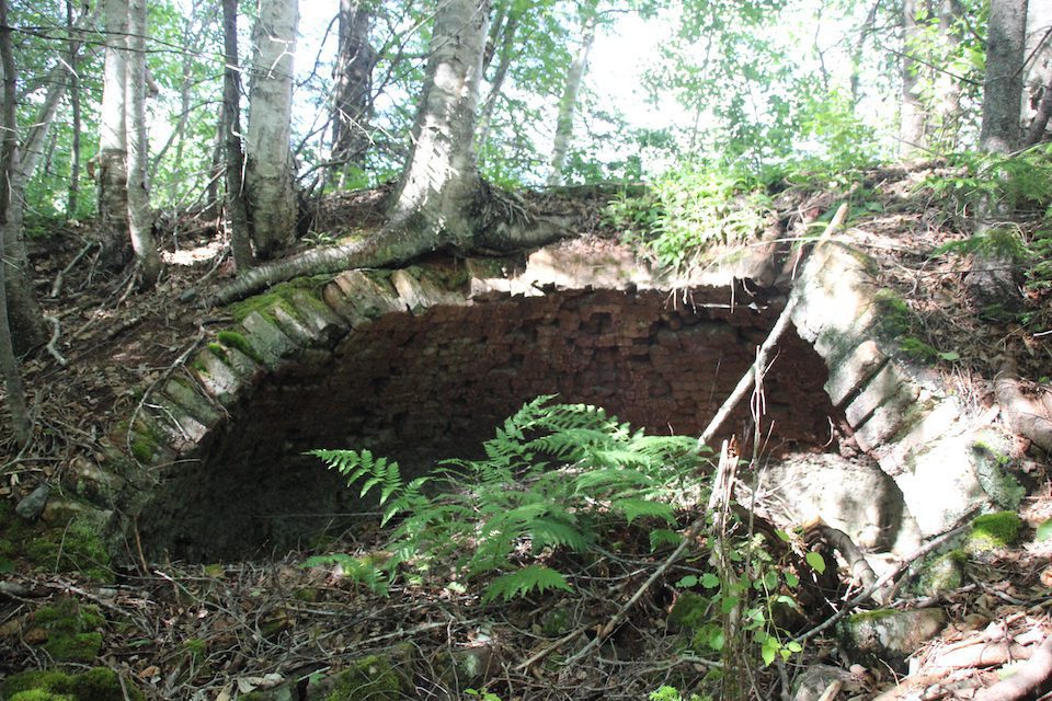
One of 50 coke ovens used in the heyday of iron production / Photo by Sandra Phinney
What’s a Geopark?
The area I’ve been exploring is part of the recently designated UNESCO Cliffs of Fundy Geopark located on part of the Gloosecap Trail in Nova Scotia. UNESCO describes a Geopark as: Single, unified geographical areas where sites and landscapes of international geological significance are managed with a holistic concept of protection, education and sustainable development.
Globally, there are 169 Geoparks in 44 countries. China has the most with 41; Canada has five. When I heard that the Cliffs of Fundy in my home province received the prized designation as a UNESCO Geopark, I was chuffed, and planned a three-day visit. With 30 “Geosites” between Debert and Apple River—a distance of 137 km—I assumed that I could visit five a day.
Arriving at Spencer’s Island at 7:30 p.m. I realize that it’s been almost eight hours since I had something to eat. Checking into the cottage, one of the owners asks, “Have you eaten?”
“No, but I have food with me. No problem.”
“We just finished supper and there’s lots of leftovers. Here. Pull up a chair.”
Within seconds I’m served a mound of roast pork laced with gravy, along with creamy mashed potatoes, and corn on the cob. I don’t let on that I’m a vegetarian. Rather, I grin my thanks and dig in with gusto.
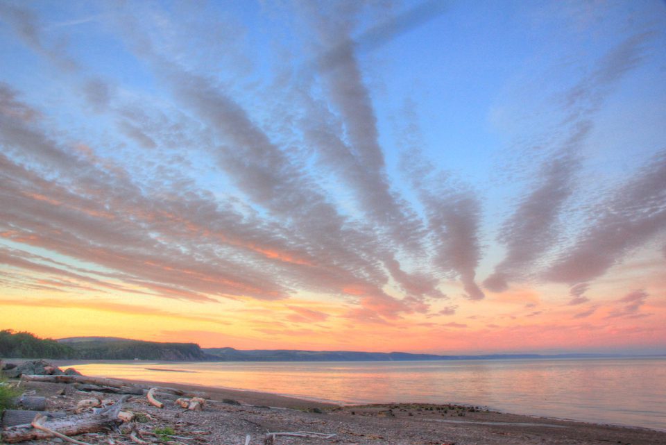
Sunset at Spencer’s Island, typical all along the Glooscap trail / Photo by Sandra Phinney
Get a grip, old girl!
The next morning, I meet my hosts again at 9 am. Laurie and Cindy Currie also operate Local Guy Adventures, a biking-hiking outdoor tour company. I’m not a pretty sight on a bike, but I did book a four-hour hike—after reading this on their website: “Step back in time on this guided hiking tour … Feel like you’re in Jurassic world as you make your way past beautiful waterfalls, old-growth forest, and trek through one of only three slot canyons in Nova Scotia. Be wowed as the nearly 200-foot canyon walls make way for lush, mossy forest and the sounds of the nearby George Fraser Falls welcome you.”
What I don’t know is that instead of viewing 200-foot canyon walls as we hike along our merry way, we’ll be going down down down the canyon then up up up again. When this becomes evident, I gulp. Get a grip old girl. You can do this. Cautiously, I proceed down the long, steep, incline, alternatively holding onto branches of trees and Laurie’s extended arm. At the bottom of the canyon, we walk along a slippery stream up to the base of the first set of falls. By now, I am so hot and exhausted I stand under the freezing cold water and let it pound over my head and fully dressed body.
Emerging, Laurie explains that we will now climb a rope up the side of the cliff, then zip-line over the gorge to the larger set of falls. Although common sense is not my strong suit, a little voice inside my 77-year-old chubby body wails ‘Noooo! Stop now or they’ll have to bring in a helicopter and medics to haul you out! Sensibly, I call it quits; my hosts are gracious—perhaps even relieved. Leaving my pride at the brook, I proceed to do the return trek up up up the forested, cathedral-like canyon—prayerfully—on my hands and knees.
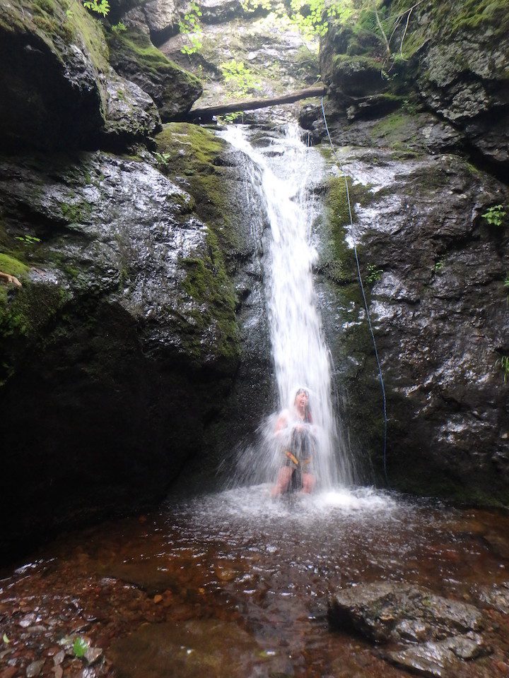
Welcome dunk at base of George Fraser Falls / Photo by Sandra Phinney
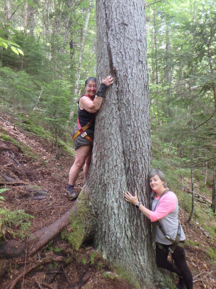
Sandra Phinney and Cindy Currie hug a tree on their way up from the slot canyon. / Photo by Sandra Phinney
On to Economy Falls
Oddly enough, after a late lunch, I get a second wind, and decide to carry on to Economy Falls—a Geosite close by in the Kenomee Wilderness Area where the majestic rock face is the edge of Avalonia, one of the tectonic jigsaw pieces of the ancient Appalachians.
Taking the River Philip Road as directed, I start looking for signs to Economy Falls. As the only sign I see says Kenomee, with an arrow to the right, I continue straight ahead. The road narrows, then disintegrates into potholes the size of bathtubs and gullies that remind me of the morning’s canyons. The road is so narrow and horrid, I can’t turn around. As my heart pounds, my anxiety level soars out of sight.
I remember Karen Armstrong—author of Through the Narrow Gate—and how she bartered with God to spare her little sister from dying of diphtheria. “Dear God,” she wrote, “If Lindsay gets better, I’ll think about being a nun.”
Becoming a nun isn’t an option, yet I can’t come up with another proposition. Instead, I fret about destroying the undercarriage, and wonder if I’ll have to spend the night in the car.
An hour later, I’m still white-knuckling my way along, when Hallelujah! Telephone poles and power lines come into view. Miraculously—within two hundred yards—is a house and a real road. I am so relieved I weep. After composing myself, I spot two gents having a yarn in a barn and I ask for directions to Economy Falls.
“Oh, it’s on the River Philip Road.”
“Yes, I was on that road but didn’t see any signs for the falls.”
“Did you drive by the big blueberry fields?”
“Yes, drove by and kept going.”
“You couldn’t have gotten far. That road’s no good.”
“But I just came through.”
“Not possible!”
“I just did. Came out just beyond your driveway. But I still don’t know where Economy Falls is.”
“Well, you should’ve turned right at the end of blueberry fields.”
“But the sign said Kenomee.”
“Yes, but that’s how you get to Economy Falls.”
* * *
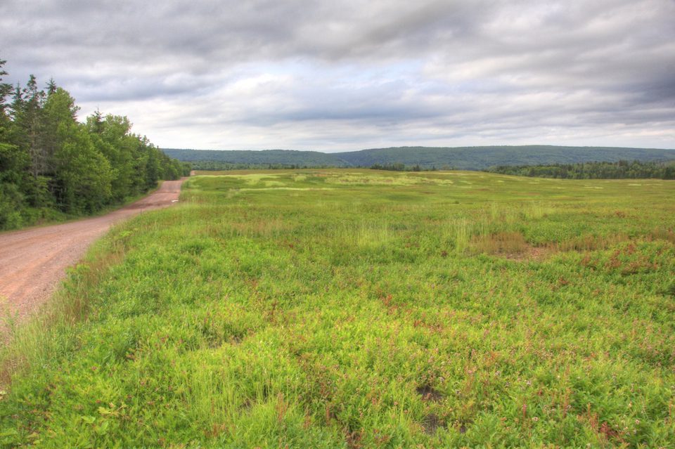
Had the writer turned right at the end of these blueberry fields, the story would have been quite different / Photo by Sandra Phinney
Being found
Historian and suffragette Miriam Beard once said, “Travel is more than the seeing of sights; it is a change that goes on, deep and permanent, in the ideas of living.”
I realized yet one more time how travel is not about checking off a list of places on a done-that-brag sheet.
Journeys are about letting things unfold, meeting new friends, and having engaging experiences. My encounters with people along the way proved that over and over again. And, yes, I did see more sites the next day including the jaw-dropping Triassic-Jurassic Fault at Five Islands, the Age of Sail Museum, and the famous “Flowerpot” at Soley Cove. Wow factor? A bulging 10 out of 10, including getting lost and found—more than once.
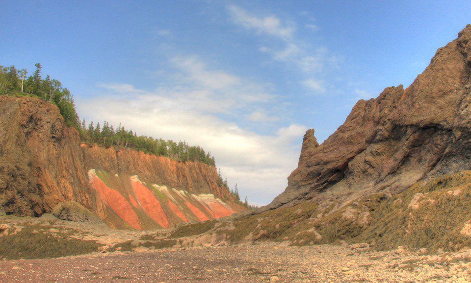
Triassic-Jurassic Fault at Five Island / Photo by Sandra Phinney
If you go
The UNESCO Cliffs of Fundy Geopark route starts in Debert, 100km from Halifax, the provincial capital of Nova Scotia.
Accommodation
I stayed at one of the cottages on Spencer’s Island managed by Laurie and Cindy, owners of Local Guy Adventures, mentioned above. It was charming and reasonably priced, with a well-equipped kitchen, all on a sandy beach mere feet from the ocean.
There are also several Inns and B&Bs in Parrsboro which is mid-way on the trail, and the town has a good selection of places to eat. Find somewhere to stay here!
Further up the coast you’ll find Wild Caraway with a couple of rooms and a famous restaurant. People actually drive two hours from Halifax to eat there. The Lighthouse on Cape d’Or is another unique place to stay where the owner is also a fabulous cook.
More of Atlantic Canada to Discover
Travel That Teaches: Enriching our Lives Through Immersive Travel Experiences
When we dive into the deep end of a culture, we can create a never-to-be-forgotten experience that enriches our lives and enhances our understanding.
Meeting a Legendary Heroine, Elder Tshaukuesh Elizabeth Penashue, in the Big Land—Labrador, Canada
Sandra Phinney recounts her experience with Tshaukuesh Elder Elizabeth Penashue while learning about the land in Labrador, Canada.
30 Less-Travelled Places for Women in 2024
For our 30th anniversary, JourneyWoman reveals 30 less-travelled places for women in 2024, according to our writers and travel experts.




0 Comments
We always strive to use real photos from our own adventures, provided by the guest writer or from our personal travels. However, in some cases, due to photo quality, we must use stock photography. If you have any questions about the photography please let us know.
Disclaimer: We are so happy that you are checking out this page right now! We only recommend things that are suggested by our community, or through our own experience, that we believe will be helpful and practical for you. Some of our pages contain links, which means we’re part of an affiliate program for the product being mentioned. Should you decide to purchase a product using a link from on our site, JourneyWoman may earn a small commission from the retailer, which helps us maintain our beautiful website. JourneyWoman is an Amazon Associate and earns from qualifying purchases. Thank you!
We want to hear what you think about this article, and we welcome any updates or changes to improve it. You can comment below, or send an email to us at [email protected].