Last updated on November 19th, 2023
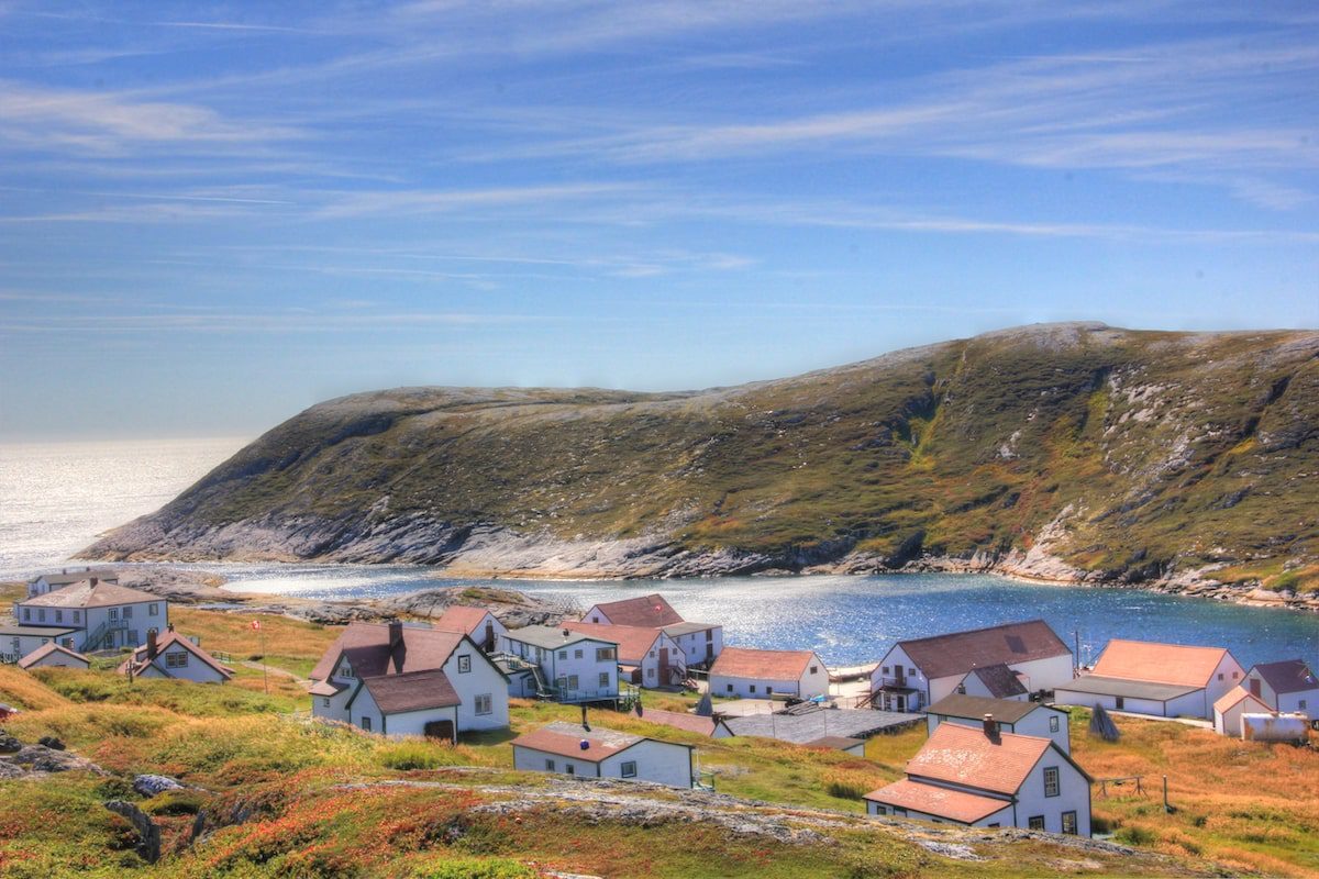
Featured image: Views of Battle Harbour, Labrador, from a hilltop | Photo by Sandra Phinney
Labrador’s small villages charm at every turn
By Sandra Phinney, Contributor, Tales From Atlantic Canada
It’s shortly after 6 p.m. early in September. I’m walking on a 4.4-km boardwalk along the coast in Rigolet, the oldest Inuit community in Labrador. This region is part of Nunatsiavut—our beautiful land—and is only accessible by ship or plane (or dog sled and snowmobile in winter).
I had arrived that morning on the Northern Ranger after a night’s sail from Happy Valley-Goose Bay. My plan is to visit three Nunatsiavut communities spanning some 300 km along the Labrador coast over six days. After settling in at the Sinittavik Bed and Breakfast, I start roaming around and enter a community centre where Inuit women are pleating moccasins. Before long they are showing me how to pleat. I’m hopeless, but gain an appreciation for the level of artistry involved.
Later, I have lunch at The Grub Box, the only place to get hot food (as well as groceries and general supplies) in the community. I smile when I see spark plugs listed at the end of the menu—a reminder of what’s important in this part of the world. “The box” has one small table, and does a brisk takeout business. My chicken burger is so good I have another one for dessert.
Day one in Nunatsiavut, Labrador
Lucky me, I’m introduced to Martin Shiwak, a retired park ranger. I accept his offer to take me scalloping in his small motorboat. Approaching the scallop beds, he drops a homemade metal rig behind his boat that fills with scallops after a short drag. After a few passes, we sort the catch, shuck scallops, and eat some au naturel. Back in Rigolet, imagine my delight when Martin gives me a bag full of shucked scallops. For supper, I sear a batch on the hot plate in my room, then sear another and another—until they’re all gone.
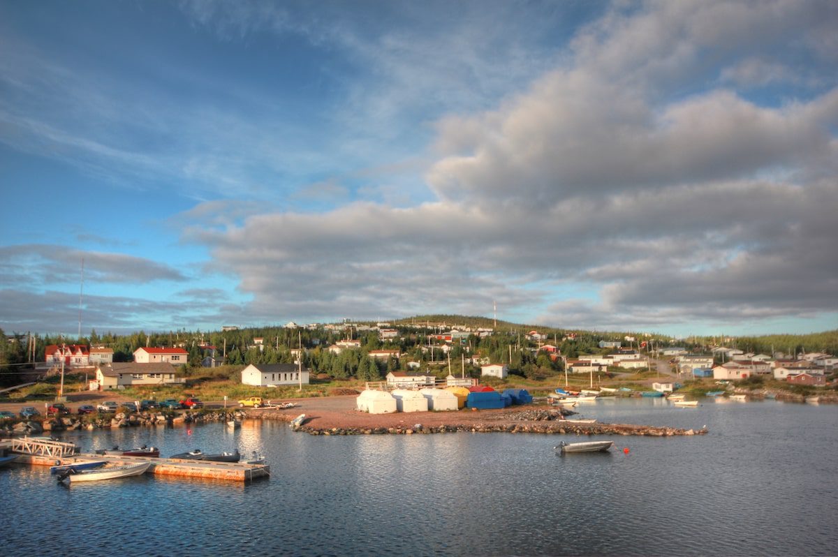
Overlooking Rigolet, Labrador / Photo by Sandra Phinney
Hiking on the boardwalk that evening before dusk was a good plan. Eventually, I spot brightly coloured kayaks sitting on the shore beside a campfire. Paddlers invite me to join them for supper, which consists of salmon and trout—stuffed with corn, green peppers, and onions—cooked on top of flat rocks over a fire next to the shore. “Love to!” I blurt, not letting on I had just eaten. As dusk starts to fall and the fish sizzle on the rocks, a full moon seeps over the horizon. Simultaneously, minke whales—locally called “grumpus”—huff and puff their way around the harbour. An hour later, we dine on fish so heavenly that I would not have been surprised to see a choir of angels float out of the forest. So ended day one in Nunatsiavut.
Stranded in Rigolet
If I told you that days two to six were just as magical, you might think I was on some funny stuff—but it’s true. Mind you, there was a wee glitch. The ferry didn’t show up two nights later for the 9 p.m. departure. Nor the next morning. Nor the next night.
So here I was, stranded in Rigolet for a few days. You might wonder: what else is there to do in a tiny community of about 300 people? The answer: plenty! For starters, I visited the Hudson’s Bay Company Net Loft Museum and the Lord Strathcona House Interpretation Centre, where volunteers love to share their history and culture. I also met up a couple of times with the kayakers, who were there on a training session with an outfitter. But mainly I wandered around, meeting folks like Holman Campbell, a seasoned trapper, and fine storyteller. After meeting Holman the first time, I was so taken with his stories that I returned and was offered an amazing meal of moose stew. Imagine that.
The Inuktitut word for tourism is silakKijattisinik. It means “the place you go to enjoy yourselves.” It’s all about going with the flow in this part of the world, where strangers are no longer strangers after the first Hello.
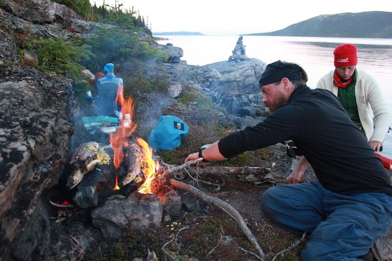
Supper on the rocks / Photo by Sandra Phinney
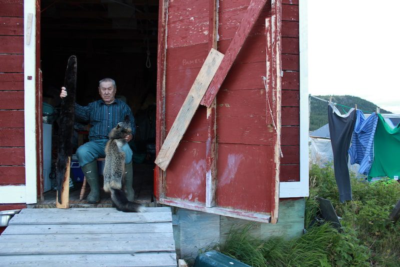
Trapper Holman Campbell / Photo by Sandra Phinney
The Big Land
Referred by some travellers as the last frontier on earth, Labrador is so vast that the rest of Atlantic Canada (including Newfoundland) could fit inside her borders.
Years before my trip up to Rigolet, and shortly after the Trans-Labrador highway opened in 2011, my husband and I decided to make the 1221 km trek across The Big Land from Labrador City to Blanc-Sablon. Towards the end of our journey, we ventured over to a small island called Battle Harbour. Fierce north-easterly winds struck the day after we arrived and getting back to the mainland was not an option. Knowing we were stranded, I danced a jig. Although this island is only 1/8 mi. wide and 1/3 mi. long, it has a big history. Bonus: there are no cars, internet, phones or TV.
Battle Harbour used to be the unofficial capital of Labrador. Back in the late 1700s, the outpost thrived on the fishery. Salmon started to run in June and were pickled and salted. Cod fishing followed, and it wasn’t uncommon to harvest cod weighing upwards of 50 pounds. Aside from pickling, salting, and drying the fish, cod livers were extracted to make valuable cod liver oil; seals were hunted for skins, meat, and oil. Ships plied the waters to Europe and the Caribbean with these precious cargos, returning with everything from salt and molasses to tobacco, tea, and rum.
Click here to find endless activities and things to do in Newfoundland and Labrador!
In 1857 the church of St. James the Apostle was consecrated on Battle Harbour, designed by famed ecclesiastical architect William Gray. In 1893, Dr. Wilfred Grenfell started a medical mission here and Labrador’s first Marconi station was installed in 1904. Before long, this little island became known far and wide for its medical services and state-of-the-art communications. On September 17, 1909, reporters from Canada and the United States feverishly recorded Robert Peary’s rendition of reaching the North Pole. The names ‘Robert Peary’ and ‘Battle Harbour’ were on everyone’s lips the world over.
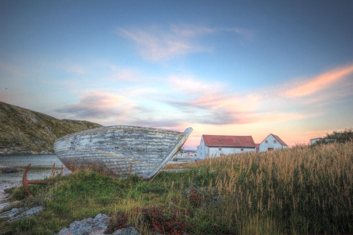
Typical scene behind the settlement in Battle Harbour / Photo by Sandra Phinney
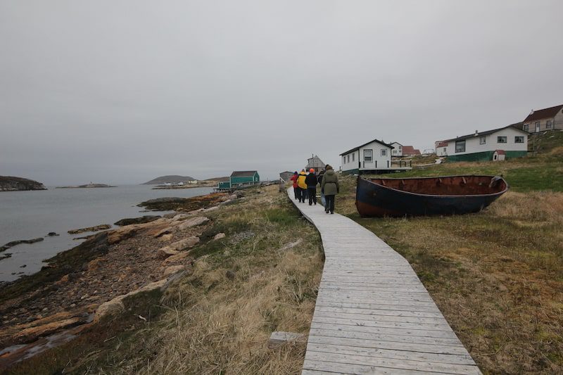
Boardwalk on Battle Harbour/ Photo by Sandra Phinney
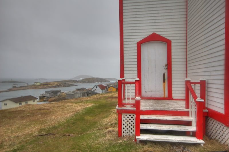
Entryway into St. James the Apostle Church / Photo by Sandra Phinney
Voices on the wind
The second time I visited Battle Harbour, I asked the locals how to get over to Great Caribou Island, just across the “tickle” (a narrow channel between two islands.) In short order, I stepped out of the skiff onto a small wooden dock in Matthew Cove. The chap who motored me over from Battle Harbour hands me a walkie-talkie.
“Call me when you get to the other side,” he says, “and I’ll fetch you back.” I sling my backpack over my shoulders and grin. “OK.”
I intend to hike around the island for a couple of hours, but first, I need to find Emma Samson and deliver some freshly-made donuts from ‘the girls’ across the tickle. Emma’s spending the last days of summer on her beloved Caribou Island.
A few hundred yards away, I see two men gutting codfish. Swiftly and silently their knives behead, slice and scrape; guts are thrown off the wharf; lurking gulls swoop in for a frenzied feed. Each splayed fish will be salted and then stored for winter. I get directions to Emma’s place.
Her eyes twinkle when I hand over the goods. We spend a little time together. She—quiet and shy. Me—curious and inquisitive. I want to linger and learn more about this woman and her island.
After a while, I check my watch and note that it’s almost 11 a.m. I have time to walk over the hill to Trap Cove, an abandoned outport before hiking to the rendezvous point. I bid farewell and follow a path uphill, downhill, then uphill again.
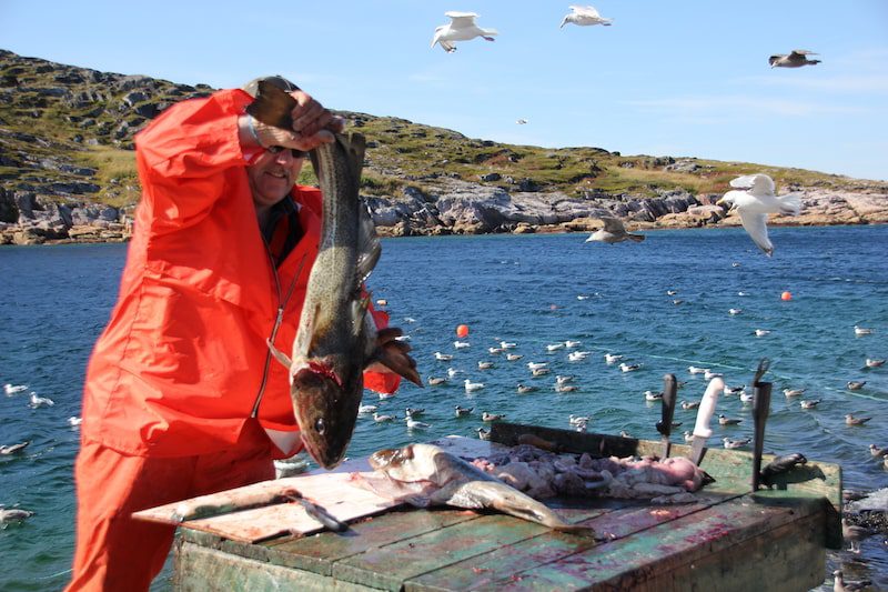
Fisherman gutting cod / Photo by Sandra Phinney
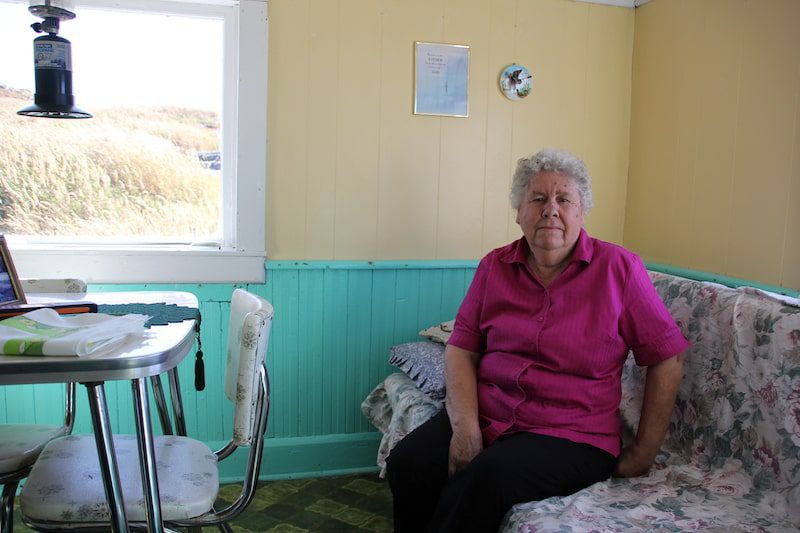
Emma Thomson enjoying summer on Caribou Island / Photo by Sandra Phinney
Approaching an abandoned structure, I can see through the non-existent front door, past three rooms, and out the back window. I think: If only this house could talk.
Around 1:30 p.m. I decide it’s time to head to my rendezvous point. Which footpath to take? I berate myself for having neither compass nor map. After trekking for two hours through peaks and gullies strewn with everything from moss-laden rocks to ferns and scraggy tuckamore, I see a lone headstone. Turning, I notice Trap Cove in the distance. I’ve made one giant two-hour circle.
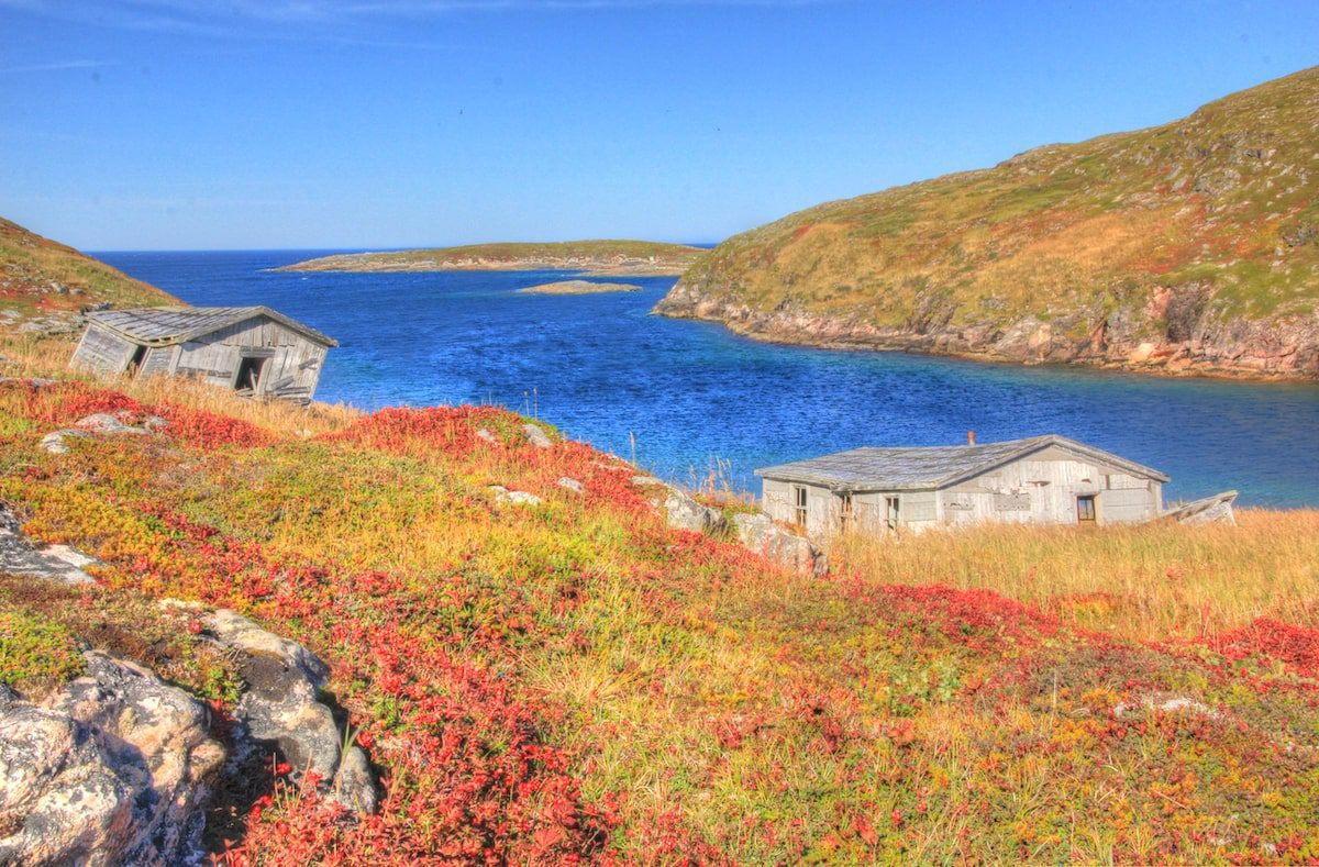
Cobalt blue sea surrounding Caribou Island / Photo by Sandra Phinney
Even though the temperature has dropped, I’m hot, sweaty—and scared. Where oh where is the right footpath? Mercifully, I swear I hear Emma’s voice saying: Go left m’luv. When you rounds the cove, heads up the hill and over. Just keeps to the left.
Forty minutes later, standing at the foot of an abandoned fishing stage facing Battle Harbour, I bow my head and murmur my gratitude. Then I pull out the walkie-talkie and call across the tickle.
People and place
I am always reminded how slow travel is all about people and place. As we know, it’s not about checking things off on a jam-crammed itinerary. It’s about building in time to get lost. Time to linger. Time to follow your nose. Time to have a cup of tea (or moose stew!) with a local.
Community residents are so friendly. They want to help. They are eager to share their culture and lifestyle and are often happy to take you to their favourite places or help get you there.
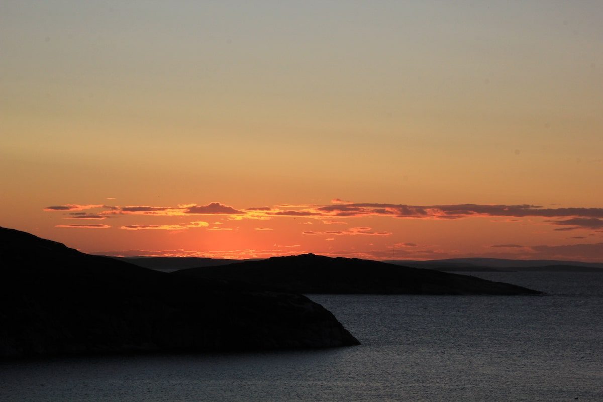
Sunset from Battle Harbour overlooking Caribou Island Labrador / Photo by Sandra Phinney
If you go to Labrador
For coastal service to the communities north and south of Happy Valley-Goose Bay, click here.
Nunatisavut: Rigolet, Makkovik, Postville, Hopedale, and Nain. More information here.
General information about Labrador found here.
For Battle Harbour information, click here.
More Tales From Atlantic Canada by Sandra
JourneyWoman’s Sandra Phinney Wins Travel Writing Awards From the Travel Media Association of Canada
Sandra Phinney, 74, is the recipient of two travel writing awards from the Travel Media Association of Canada for her stories about Canada’s East Coast.
Travel That Teaches: Enriching our Lives Through Immersive Travel Experiences
When we dive into the deep end of a culture, we can create a never-to-be-forgotten experience that enriches our lives and enhances our understanding.
Meeting a Legendary Heroine, Elder Tshaukuesh Elizabeth Penashue, in the Big Land—Labrador, Canada
Sandra Phinney recounts her experience with Tshaukuesh Elder Elizabeth Penashue while learning about the land in Labrador, Canada.


Such delightful and informative articles from Sandra. Thank you so much! They have brought back memories of wonderful times travelling through Canada (I live in Melbourne, Australia) – dog sledding from Herschel Island, across sea ice to the mainland and on to Aklavik; sailing and hiking in the Great Bear Rainforest area (black bears, spirit bears, humpback whales, orca, minke whales); meeting interesting people in Montreal, Toronto and Vancouver; and Labrador is now on my list.
Next week I’m flying to Australia’s Top End (Darwin, Northern Territory), camping/glamping in the bush for 2 nights, then sailing from Darwin around the Kimberley Coast to Broome. After delays due to the pandemic, it will be fantastic to see these parts of my country, and to meet people along the way.
Thanks so much for your kind words Elane! And it sounds as if you have lots on the go and much to celebrate in your traveling life. YAY!